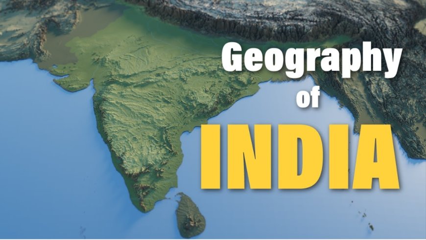
Indian Geography is vast and diverse country located in South Asia.
India, officially known as India, is a vast and diverse country located in South Asia. It is the seventh-largest country in the world and is surrounded by the Himalayas in the north, the Arabian Sea in the west, and the Bay of Bengal in the east.
 Avya7800
1. Location and Extent
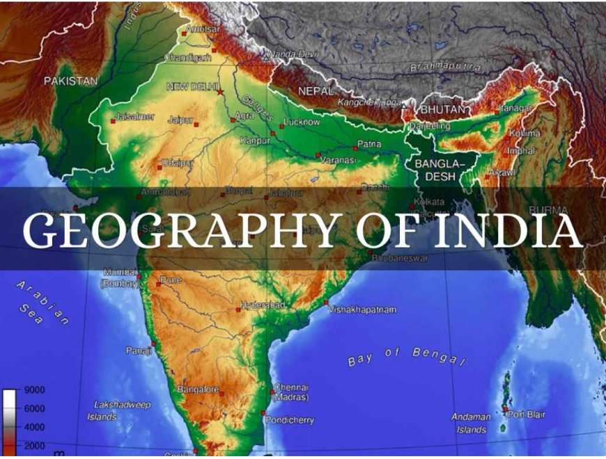
India lies entirely in the Northern Hemisphere and partly in the Eastern Hemisphere. It extends between latitudes 8°4′N and 37°6′N and longitudes 68°7′E and 97°25′E. The Tropic of Cancer divides the country into tropical and subtropical regions.
India shares its borders with several countries:
To the north: China, Nepal, and Bhutan
To the west: Pakistan
To the east: Bangladesh and Myanmar
Across the sea: Sri Lanka and Maldives
The southernmost point of India is Kanyakumari, where the Arabian Sea, Bay of Bengal, and Indian Ocean meet.
2. Physical Divisions of India
India can be divided into six major physical divisions:
(a) The Himalayan Mountains
The Himalayas are the youngest fold mountains in the world and form India’s northern boundary. They act as a natural barrier protecting the country from cold winds and foreign invasions.
The Himalayas are divided into three ranges:
Himadri (Greater Himalayas): Highest peaks, including Mount Everest
Himachal (Lesser Himalayas): Hill stations and valleys
Shiwalik (Outer Himalayas): Low hills with forests
These mountains are the source of many major rivers like the Ganga, Yamuna, and Brahmaputra.
(b) The Northern Plains
Formed by the deposition of alluvial soil by rivers, the Northern Plains are among the most fertile regions in the world. They are divided into:
Punjab Plains
Ganga Plains
Brahmaputra Plains
These plains support dense populations and intensive agriculture, making them the food basket of India.
(c) The Peninsular Plateau
The Peninsular Plateau is the oldest landmass of India and is made up of hard igneous and metamorphic rocks. It is divided into:
Central Highlands
Deccan Plateau
Important rivers like the Narmada and Godavari flow through this region. The plateau is rich in minerals like coal, iron, and manganese.
(d) The Indian Desert
The Thar Desert lies in the western part of India, mainly in Rajasthan. It is characterized by:
Sandy soil
Low rainfall
Sparse vegetation
Despite harsh conditions, people have adapted through irrigation and traditional lifestyles.
(e) The Coastal Plains
India has a long coastline of about 7,500 km. The coastal plains are divided into:
Western Coastal Plains (Arabian Sea side)
Eastern Coastal Plains (Bay of Bengal side)
Major ports like Mumbai and Chennai are located here. These regions are important for trade, fishing, and tourism.
(f) The Islands
India has two major groups of islands:
Andaman and Nicobar Islands
Lakshadweep Islands
These islands are important for biodiversity, tourism, and strategic location.
3. Climate of India
India has a monsoon type of climate, influenced by seasonal winds.
Seasons:
Summer (March–June)
Monsoon (June–September)
Winter (October–February)
The Monsoon is the most important climatic factor, bringing rainfall essential for agriculture. Variations in climate occur due to altitude, distance from the sea, and geographical features.
4. Drainage System
India’s rivers are lifelines of the country and are divided into two types:
(a) Himalayan Rivers
Perennial (flow throughout the year)
Examples: Ganga, Yamuna, Brahmaputra
(b) Peninsular Rivers
Seasonal (dependent on rainfall)
Examples: Godavari, Krishna, Kaveri
Rivers are crucial for irrigation, drinking water, hydroelectric power, and transportation.
5. Natural Vegetation
India’s vegetation varies according to climate and soil. Major types include:
Tropical evergreen forests
Tropical deciduous forests
Thorn forests
Mountain forests
Mangrove forests
The Sundarbans is the largest mangrove forest in the world and is home to the Bengal tiger.
6. Soil Types in India
India has diverse soil types:
Alluvial soil (fertile, found in plains)
Black soil (ideal for cotton cultivation)
Red soil
Laterite soil
Desert soil
Soil diversity supports different crops across regions.
7. Agriculture in India
Agriculture is the backbone of India’s economy. Major crops include:
Rice
Wheat
Sugarcane
Cotton
Tea
The Green Revolution increased food production significantly in India.
8. Mineral Resources
India is rich in mineral resources:
Coal
Iron ore
Bauxite
Mica
The Peninsular Plateau is the main mineral-rich region.
9. Population and Settlement
India is the second-most populous country in the world. Population distribution depends on:
Fertility of land
Availability of water
Climate
Dense populations are found in the Northern Plains, while deserts and mountains have sparse populations.
10. Transport and Communication
India has a well-developed transport network:
Railways
Roadways
Airways
Waterways
The Indian Railways is one of the largest railway networks in the world.
11. Importance of Indian Geography
Indian geography influences:
Climate and weather patterns
Agriculture and economy
Culture and traditions
Biodiversity
The Himalayas protect the country, rivers support agriculture, and coastal regions boost trade.
Conclusion
Indian geography is a unique blend of natural diversity and cultural richness. From the snow-covered peaks of the Himalayas to the fertile plains, from deserts to lush forests, and from plateaus to islands, every region contributes to the identity of India. This geographical diversity has shaped the lifestyle, economy, and culture of the people for centuries.
Understanding Indian geography is essential not only for academic knowledge but also for appreciating the natural beauty and complexity of the country.