Heavy Rain Alert Across Odisha: IMD Warns of Intense Monsoon Activity
Heavy Rain Alert Across Odisha: IMD Warns of Intense Monsoon Activity
 Madhavisanvi
Heavy Rain Alert Across Odisha: IMD Warns of Intense Monsoon Activity
Odisha is facing another spell of active monsoon weather, with the India Meteorological Department (IMD) warning of heavy to very heavy rainfall in parts of the state as a weather system develops over the Bay of Bengal. Recent reports indicate that a low-pressure area is likely to strengthen rainfall activity over Odisha from August 12.
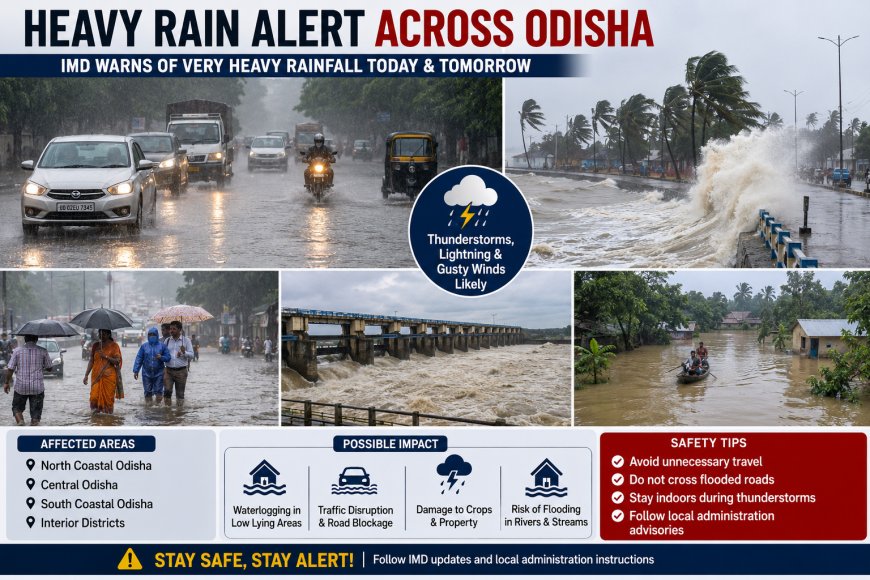
The latest weather outlook suggests that rain will not be limited to a single district. Several parts of Odisha may experience periods of intense rainfall, accompanied by thunderstorms, lightning and gusty winds. The broader monsoon situation is also active across eastern and northeastern India, increasing the possibility of weather-related disruption.
Why is Odisha receiving heavy rain?
The main reason behind the worsening weather is the development of a low-pressure system over the Bay of Bengal. Such systems are common during the southwest monsoon and can draw large amounts of moisture toward Odisha.
When a low-pressure system interacts with the prevailing monsoon circulation, rainfall can become widespread and locally intense. Coastal districts may receive particularly active weather because of their proximity to the Bay of Bengal, while inland districts can also experience heavy showers as the system moves or changes intensity.
Reports published ahead of today's weather event indicated that rainfall activity was expected to increase from August 12, making the next several days important for weather monitoring.
Heavy rainfall could affect normal life
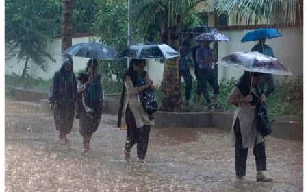
Intense rainfall over a short period can quickly create waterlogging in urban areas, particularly where drainage systems are unable to handle large volumes of water. Roads and low-lying areas may become temporarily inundated, affecting commuters and local transportation.
In rural areas, heavy rain can create additional difficulties for farmers and residents living near rivers, canals and other water bodies. Saturated soil can also increase the risk of localized flooding and damage to crops, particularly where rain continues for several consecutive days.
The risk is more significant in areas that have already received substantial rainfall. Continued precipitation can increase water levels in rivers and streams and put additional pressure on drainage and flood-management systems.
Thunderstorms and lightning remain a concern
Rainfall is not the only weather hazard expected during this period. Thunderstorms, lightning and strong gusty winds can accompany the showers.
Lightning is particularly dangerous because it can occur suddenly, sometimes before or after the heaviest rain. Residents should avoid open fields, isolated trees, rooftops and other exposed locations when thunderstorms are approaching.
People should also avoid unnecessary travel during severe thunderstorms and follow warnings issued by local authorities.
Impact on agriculture
Agriculture is an important part of Odisha's economy, so changes in rainfall can have a significant effect on farming activity.
Moderate monsoon rainfall is beneficial for crops because it replenishes soil moisture and supports agricultural operations. However, excessive rainfall within a short period can become damaging.
Standing crops may be affected by waterlogging, while fields located in low-lying areas can remain submerged if drainage is poor. Farmers should therefore monitor local weather advisories and take appropriate precautions for harvested crops, livestock and agricultural equipment.
Flood and waterlogging risk
Heavy rainfall does not automatically mean that widespread flooding will occur. However, the possibility of localized flooding and waterlogging increases when intense rainfall continues over several days.
Residents living close to rivers, streams and low-lying areas should remain alert to changes in water levels. Local administrations may also monitor vulnerable locations and drainage systems as rainfall intensifies.
The situation can change rapidly because rainfall distribution is often uneven. One district may receive relatively moderate rain while another nearby area experiences a much heavier downpour.
What residents should do
People across Odisha should take basic precautions during this period of unsettled weather:
-
Follow the latest IMD and district administration advisories.
-
Avoid unnecessary travel during periods of very heavy rain.
-
Stay indoors during thunderstorms and lightning.
-
Do not shelter under isolated trees during lightning.
-
Avoid crossing flooded roads, streams or waterlogged areas.
-
Keep mobile phones and essential devices charged during severe weather.
-
Farmers should monitor rainfall and river-level updates before entering vulnerable agricultural areas.
-
Residents in low-lying locations should remain prepared for possible temporary waterlogging or evacuation instructions.
Outlook for the coming days
The weather situation is expected to remain unsettled beyond today, with rain continuing across parts of Odisha. Current forecast data shows rainfall chances persisting through the coming days, although the intensity and distribution can vary significantly from district to district.
The important point is that Odisha remains under an active monsoon pattern, and residents should not assume that a temporary reduction in rainfall means the weather system has completely weakened.
Weather forecasts can also change as the low-pressure system develops and moves. Therefore, people should rely on the latest official bulletins rather than older forecasts circulating on social media.