Monsoon Remains Active Across India
Monsoon Remains Active Across India
 Madhavisanvi
Monsoon Remains Active Across India: Heavy Rain and Travel Disruptions
India is experiencing another active phase of the southwest monsoon, with several regions expected to receive heavy to very heavy rainfall. According to the latest weather outlook, widespread rainfall is likely across parts of the Himalayan region, northeast India, eastern India, central India and the southern peninsula. Thunderstorms, lightning and gusty winds may accompany rainfall in several areas.
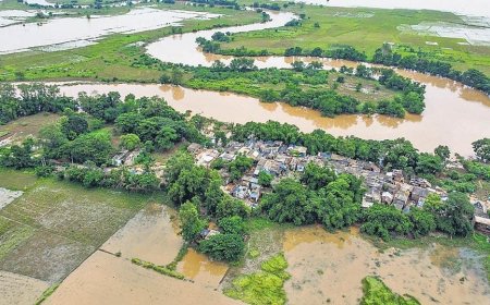
The current spell is important because rainfall is occurring across geographically different regions at the same time. While rain is beneficial for agriculture, reservoirs and groundwater, intense or prolonged showers can create problems such as waterlogging, flash flooding, landslides and disruptions to transport.
Several regions remain under heavy-rain watch
The Himalayan region is expected to experience continued rainfall, with areas of Jammu and Kashmir, Ladakh, Himachal Pradesh and Uttarakhand among those being monitored. Heavy rainfall in mountainous areas can increase the risk of landslides, falling rocks and temporary road closures. The IMD has forecast periods of heavy rainfall in parts of the western Himalayan region during the coming days.
Northeastern India is another important area of concern. Assam, Meghalaya, Arunachal Pradesh and other northeastern states can experience intense monsoon showers, with some areas facing the possibility of very heavy rainfall. Heavy rain in the Northeast can cause rapid rises in streams and rivers and increase the risk of landslides in hilly terrain. Eastern India is also expected to remain wet. Odisha, West Bengal and Jharkhand are among the states experiencing significant rainfall activity. In Odisha specifically, the IMD's August 12 warning lists very heavy rain for August 12 and 13, followed by heavy rain through August 18.
⚡ Thunderstorms and lightning add to the risk
Heavy rain is not the only concern during this monsoon spell. Thunderstorms, lightning and strong winds are expected in several areas.
The latest national weather outlook indicates that gusty winds could accompany thunderstorms in parts of the country, while some areas may experience particularly strong winds during storm activity.
Lightning can become a serious hazard, particularly for people working outdoors, farmers, construction workers and commuters. People should move indoors when thunderstorms approach and avoid open fields, isolated trees, rooftops and other exposed locations.
Road travel could be affected
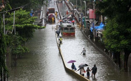
One of the most immediate effects of heavy rainfall is disruption to road transportation.
Intense showers can overwhelm urban drainage systems, leaving roads waterlogged. Visibility can also drop sharply during heavy rain, making driving more difficult. In rural and hilly areas, overflowing streams, mudslides and damaged roads can temporarily interrupt connectivity.
Drivers should reduce speed during heavy rain and avoid attempting to cross roads where floodwater is moving rapidly. Even relatively shallow-looking water can conceal potholes, damaged road surfaces or strong currents.
Rail services may also face challenges
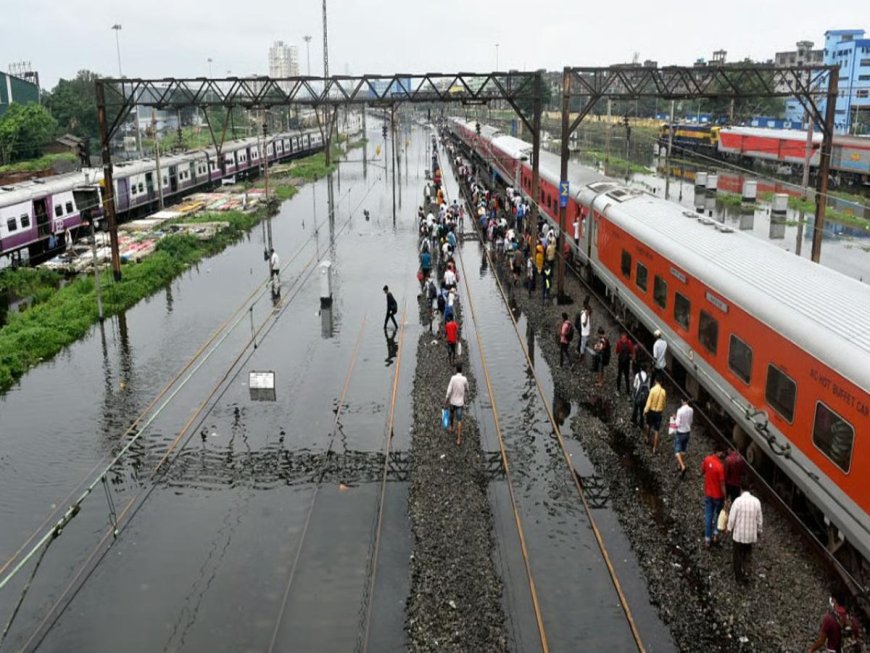
Heavy rainfall can affect railway operations when water accumulates around tracks or when landslides and debris obstruct routes. In areas vulnerable to flooding, railway authorities may need to impose speed restrictions or make operational changes for passenger safety.
Passengers travelling during periods of severe weather should check the latest train status before leaving home and allow additional time for possible delays.
✈️ Air travel could see delays
Thunderstorms and strong winds can also affect aviation. Heavy rain and poor visibility may lead to flight delays, diversions or changes in airport operations, particularly when storms develop near airports.
Travellers should check airline notifications and airport updates before beginning their journey. Keeping extra time between connecting flights may also be advisable during periods of widespread severe weather.
Flooding and waterlogging concerns
Another major concern is the possibility of localized flooding.
When rainfall is intense, water can accumulate faster than drainage systems can remove it. Urban areas may therefore experience waterlogging, while rural areas near rivers and streams can face temporary flooding.
The danger can increase when heavy rainfall continues over several days because the soil becomes saturated and rivers and drainage channels carry more water. Authorities consequently monitor rainfall totals, river levels and vulnerable locations during prolonged monsoon spells.
⛰️ Landslide risk in mountainous areas
In the Himalayan states and other hilly regions, prolonged rainfall presents a different danger: landslides.
Continuous rain can weaken soil and rock on steep slopes. Landslides can block highways, damage houses and disrupt access to remote communities. Travellers should be particularly careful on mountain roads during periods of heavy rainfall and should follow local administration instructions if roads are declared unsafe.
Impact on agriculture
The active monsoon has a mixed impact on India's agricultural sector.
Regular rainfall is essential for crops, particularly during the kharif season. Adequate rainfall improves soil moisture and supports crops such as rice, pulses, maize, cotton and soybean.
However, excessive rainfall can also create problems. Fields may become waterlogged, crops can suffer from prolonged standing water, and soil erosion can damage agricultural land.
There is also an important regional difference: while some parts of the country are experiencing excessive rainfall, other areas may receive less rain than needed. A recent Reuters report noted that India's monsoon rainfall was running below average overall and that the distribution of rainfall remained uneven.
Why the monsoon situation can change quickly
Monsoon rainfall is influenced by several interacting weather systems, including low-pressure areas, cyclonic circulations and the position of the monsoon trough.
As these systems develop and move, rainfall can shift from one region to another. A district receiving moderate rain one day may experience a much heavier spell the next day.
This is why people should rely on the latest IMD forecasts and district-level warnings rather than assuming that a general national forecast applies equally to every location.
Safety precautions for the public
People living in areas under heavy-rain warnings should take several basic precautions:
-
Check the latest IMD warning before travelling.
-
Avoid unnecessary journeys during very heavy rain.
-
Never drive through deep or rapidly moving floodwater.
-
Stay indoors during thunderstorms and lightning.
-
Do not take shelter under isolated trees.
-
Keep away from damaged electrical infrastructure and fallen power lines.
-
In hilly areas, avoid roads where landslides or falling rocks are possible.
-
Keep essential medicines, documents, drinking water and emergency supplies accessible.
-
Follow evacuation or movement instructions issued by local authorities.