Flash-Flood Risk Remains a Concern in Odisha
Flash-Flood Risk Remains a Concern in Odisha
 Madhavisanvi
Flash-Flood Risk Remains a Concern in Odisha
Odisha continues to face a weather-related risk as heavy rainfall and the possibility of intense, short-duration downpours raise concerns about flash flooding in vulnerable areas. The India Meteorological Department (IMD) has identified flash-flood risk as an important hazard during periods of persistent or intense rainfall. Recent IMD bulletins have previously placed several Odisha districts under low-to-moderate flash-flood risk, particularly where soils are saturated and additional rainfall can quickly generate surface runoff.
The latest all-India weather bulletin issued on August 11, 2026 also forecasts isolated heavy rainfall over Odisha, while a developing low-pressure area over the northwest Bay of Bengal and adjoining region is expected to increase monsoon activity around the state.
What is a flash flood?
A flash flood is a rapid rise of water that can occur within a relatively short period after intense rainfall. Unlike a traditional river flood, which may develop over a longer period as water gradually accumulates upstream, a flash flood can develop quickly in low-lying areas, small river catchments, urban drainage systems, hilly terrain and areas with saturated soil.
When rainfall is particularly intense, the ground may not be able to absorb water quickly enough. Instead, water begins flowing across the surface and collects in natural drainage channels, streams, roads and low-lying locations.
This is why even areas that are not immediately next to a major river can experience sudden flooding.
Why Odisha is vulnerable
Odisha's geography makes parts of the state susceptible to flooding during periods of intense monsoon rainfall. The state has a large network of rivers, streams, canals and drainage channels, while several communities live in low-lying and flood-prone areas.
During prolonged rainfall, soil can become saturated. Once the ground reaches its absorption capacity, additional rainwater runs across the surface instead of entering the soil.
This process can happen particularly quickly when another intense rainfall spell follows several days of wet weather.
Previous IMD flash-flood guidance has identified districts including Angul, Balangir, Balasore, Bargarh, Bhadrak, Deogarh, Dhenkanal, Jajpur, Keonjhar, Mayurbhanj, Sambalpur and Subarnapur among areas where low-to-moderate flash-flood risk was forecast during earlier heavy-rain episodes.
A flash-flood risk designation, however, does not mean that flooding will definitely occur in every listed district. It indicates that certain watersheds or neighbourhoods may become vulnerable if sufficient rainfall occurs.
Heavy rainfall can quickly change local conditions
One of the biggest challenges with flash flooding is the speed at which conditions can change.
A location may initially experience ordinary rainfall, but a concentrated period of very heavy rain can produce large amounts of runoff within a short time. Small streams can rise rapidly, drainage systems can become overwhelmed and water can accumulate on roads.
In urban areas, blocked or inadequate drainage can make the situation worse. Roads, parking areas and other paved surfaces do not absorb much water, meaning rainfall can quickly flow toward lower areas.
If drains are already full because of previous rainfall, additional water may have nowhere to go.
Low-lying communities face greater risks
People living near rivers, streams, canals and drainage channels should be particularly cautious during intense rainfall.
Low-lying settlements can experience flooding even when rainfall is occurring some distance away. Water from higher ground may flow toward lower areas, causing sudden increases in water levels.
Residents should therefore avoid assuming that a location is safe simply because rainfall at that particular moment is moderate.
Roads and transportation may be affected
Flash flooding can also cause serious disruption to transportation.
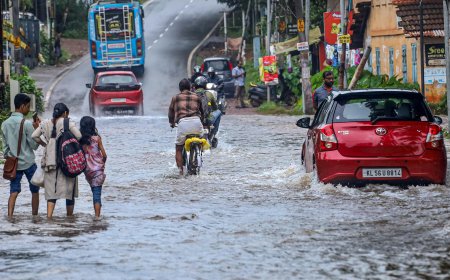
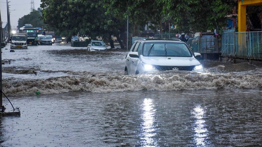
Water can accumulate on roads, reduce visibility and make it difficult for drivers to determine the depth of flooded sections. In some cases, roads can become unsafe very quickly.
Motorists should avoid attempting to cross fast-flowing water or flooded roads, particularly where the depth of the water cannot be clearly assessed.
Floodwater can conceal potholes, damaged road surfaces, open drains and other hazards. Strong currents can also affect vehicles and pedestrians.
Rivers and small streams require monitoring
Authorities may need to monitor not only major rivers but also small streams, tributaries and local drainage channels.
Small watercourses can respond rapidly to intense rainfall. Their water levels can rise much faster than those of larger rivers.
This is particularly important in areas where rainfall occurs repeatedly over the same watershed. Water from several locations can converge into a single channel, increasing the flow and potentially causing flooding downstream.
Agriculture could also be affected
Farmers may welcome normal monsoon rainfall because it provides essential moisture for crops. However, excessive rainfall can create problems when fields remain waterlogged for extended periods.
Standing water can affect crop roots, delay agricultural operations and make it difficult for farmers to move machinery or transport harvested produce.
For farmers in low-lying areas, drainage becomes particularly important during prolonged rainfall.
At the same time, rainfall can replenish ponds, reservoirs and groundwater resources. Therefore, the impact of heavy rain is not entirely negative; the main concern is excessive rainfall concentrated over a short period or continuing for several days.
Urban flooding is another concern
Flash-flood risk is not limited to rural areas.
Cities and towns can experience rapid water accumulation when rainfall exceeds the capacity of drainage systems. Roads covered with concrete and asphalt allow relatively little water to infiltrate the ground, causing runoff to move quickly toward low points.
If drains are blocked by waste, mud or other debris, the problem can become more severe.
Regular cleaning and maintenance of drainage networks can therefore play an important role in reducing urban flooding.
Thunderstorms and lightning add another hazard
Heavy rainfall may occur alongside thunderstorms and lightning. The IMD's August 11 bulletin forecasts isolated heavy rainfall over Odisha, while thunderstorms and lightning are also expected in parts of the country during the forecast period.
People should take lightning warnings seriously. During thunderstorms, it is safer to remain indoors and avoid open fields, isolated trees, water bodies and exposed locations.
Farm workers, fishermen, construction workers and people travelling outdoors can be particularly vulnerable during lightning activity.
Importance of early warnings
Early-warning systems are extremely important when flash-flood risk increases.
IMD's flash-flood guidance focuses on specific watersheds and neighbourhoods rather than suggesting that an entire state will necessarily flood. Earlier bulletins have described possible surface runoff and inundation in fully saturated soils and low-lying areas when additional rainfall is expected.
This information can help local authorities prepare before conditions deteriorate.
Possible preparedness measures include monitoring water levels, checking drainage systems, keeping emergency teams ready and warning residents in vulnerable locations.
What residents should do
People in areas vulnerable to flash flooding should remain alert when heavy rainfall is forecast.
Residents can take several basic precautions:
-
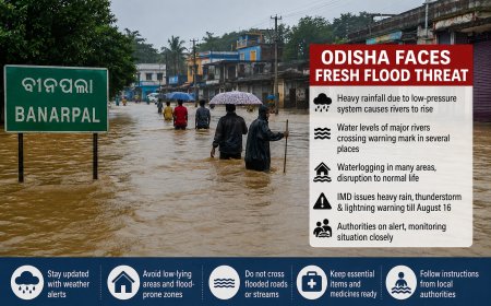
Keep track of official IMD and local administration warnings.
-
Avoid unnecessary travel during intense rainfall.
-
Never attempt to walk or drive through rapidly flowing floodwater.
-
Stay away from rivers, streams, canals and overflowing drains.
-
Keep important documents and essential items in a safe, elevated place if flooding is possible.
-
During lightning, move indoors and avoid exposed locations.
-
Follow evacuation instructions if authorities issue them.
The most important principle is not to underestimate rapidly rising water.
Role of local administration
Local authorities have an important role in reducing the impact of flash floods. Continuous monitoring of vulnerable locations can allow officials to respond before a situation becomes dangerous.
Authorities may need to inspect drainage systems, monitor water levels and identify roads or settlements that could become isolated.
Emergency services also need to remain prepared for incidents involving stranded residents, flooded roads and damaged infrastructure.
Coordination between weather agencies, district administrations, disaster-management teams and local communities can make warnings more effective.
Why the coming days deserve attention
The flash-flood concern becomes more significant when heavy rainfall occurs over several consecutive days.
The IMD's August 11 all-India bulletin forecasts heavy rainfall at isolated places over Odisha, while its August 10 release says a low-pressure area is likely to form over the northwest Bay of Bengal and adjoining areas around August 12. Such a system can contribute to increased rainfall activity over eastern India.
This does not mean every part of Odisha will experience flooding. Rather, areas that receive particularly intense rainfall—especially locations with saturated ground, poor drainage or nearby watercourses—could face greater localized risk.
A situation that requires preparedness, not panic
A low-to-moderate flash-flood risk should not be interpreted as a prediction that widespread flooding is certain.
Instead, it is an indication that specific vulnerable watersheds and neighbourhoods could experience rapid runoff or inundation if rainfall conditions become intense enough. IMD's earlier guidance explicitly described such risks in terms of possible surface runoff and inundation in saturated and low-lying areas.
The best response is therefore preparedness rather than panic.
Residents should stay informed, local authorities should monitor vulnerable locations, and people should respond promptly to official warnings.