CM Mohan Charan Majhi to Survey Flood-Hit Areas in Odisha
CM Mohan Charan Majhi to Survey Flood-Hit Areas in Odisha
 Madhavisanvi
CM Mohan Charan Majhi to Survey Flood-Hit Areas in Odisha
Odisha Chief Minister Mohan Charan Majhi is scheduled to conduct an aerial survey of flood-affected areas today, focusing particularly on districts that have suffered significant damage from heavy rainfall, rising river levels and flooding. The proposed aerial assessment comes at a critical time, as several parts of the state continue to face the consequences of intense monsoon activity.
The Chief Minister’s visit is expected to provide a direct assessment of the ground situation and help the state government determine where immediate relief, rescue and rehabilitation measures are required. An aerial survey is particularly useful during a flood because many affected villages, roads, agricultural fields and low-lying settlements may be difficult to reach by road.
A critical assessment of the flood situation
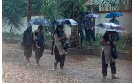
Odisha has frequently faced floods during the monsoon season because of its extensive network of rivers, low-lying coastal areas and heavy seasonal rainfall. When rainfall becomes intense over several days, rivers can rise rapidly and drainage systems can come under considerable pressure.
The current situation has created concerns in several districts, particularly in northern Odisha. Rising water levels in major rivers and continued rainfall can increase the possibility of flooding in low-lying communities.
Against this backdrop, the Chief Minister’s aerial survey is significant because it will allow the government to obtain a broader picture of the situation.
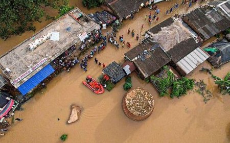
From the air, officials can assess the extent of inundation across large areas, identify villages that may have become isolated, examine the condition of roads and bridges, and evaluate the impact on agricultural land.
Why an aerial survey is important
During a major flood, reaching every affected location by road can be extremely difficult. Roads may be submerged, bridges may be damaged and transportation may be interrupted.
An aerial survey allows senior officials to observe affected areas without being limited by road conditions. It can provide a wider picture of:
-
Flooded villages
-
Submerged roads
-
Agricultural losses
-
River overflow
-
Waterlogged residential areas
-
Damaged infrastructure
-
Isolated communities
-
Areas requiring evacuation
-
Locations where relief supplies may be needed
The information gathered during such an assessment can help the administration prioritize its response.
Focus on badly affected districts
The Chief Minister is expected to pay particular attention to districts that have experienced the most serious effects of flooding.
Areas located close to major rivers are especially vulnerable when water levels rise. Low-lying settlements can become surrounded by floodwater, while agricultural fields may remain submerged for extended periods.
For residents in these areas, the immediate priorities are safety, evacuation where necessary, food, drinking water, medical assistance and communication facilities.
The aerial survey can help identify areas where these requirements are greatest.
Impact on villages
Flooding can have a severe impact on rural communities.
Many villages depend heavily on agriculture and livestock for their livelihoods. When floodwater enters agricultural fields, standing crops can be damaged or destroyed. Farmers may also lose livestock or face difficulty accessing their cattle and other animals.
Floodwater can also enter houses, forcing families to move to safer and higher locations.
In some areas, people may remain temporarily isolated because roads connecting their villages to nearby towns become submerged.
For such communities, government assistance needs to reach them quickly.
Agriculture among the biggest concerns
Agricultural damage is one of the major economic consequences of flooding in Odisha.
Farmers invest considerable amounts of money and labour in preparing their fields and growing crops. Prolonged flooding can damage seedlings and standing crops and can also affect soil conditions.
Paddy cultivation is particularly important across large parts of Odisha. If farmland remains underwater for a long period, farmers may suffer significant losses.
An aerial survey can provide an initial indication of how extensively agricultural land has been affected.
However, detailed crop-loss assessment generally requires subsequent field-level surveys by government officials.
Roads and bridges under pressure
Flooding can severely affect transportation infrastructure.
When roads are submerged, people may be unable to travel between villages and nearby towns. Damaged bridges and culverts can further complicate the situation.
Emergency teams may have difficulty reaching affected communities if normal transportation routes are blocked.
The aerial survey can help authorities identify important transportation links that have been damaged or cut off and determine where restoration work may need to be prioritized.
Relief and rescue operations
Rescue and relief operations become the immediate priority when floodwaters threaten homes and communities.
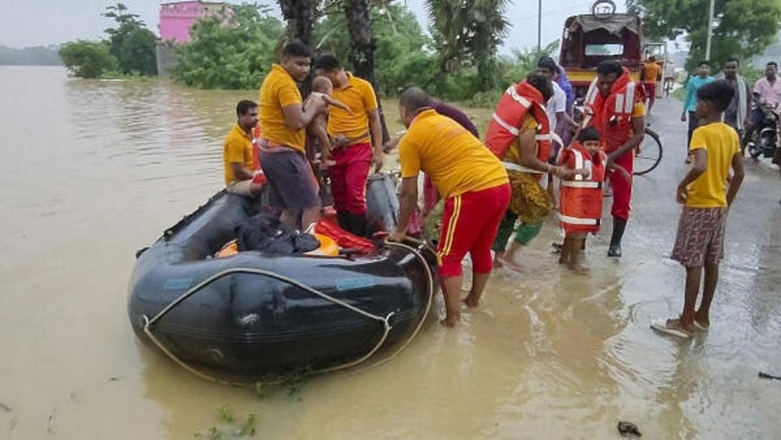
Government agencies and disaster-response teams may need to evacuate residents from vulnerable locations. Boats and other rescue equipment can become essential when roads are submerged.
Relief camps may also be required for families who have been displaced.
Such camps need adequate supplies of:
-
Drinking water
-
Food
-
Medicines
-
Sanitation facilities
-
Temporary shelter
-
Electricity or lighting
-
Basic household necessities
The Chief Minister’s assessment can help determine whether existing relief arrangements are sufficient or whether additional resources are required.
Protecting vulnerable people
During a flood, certain groups require special attention.
These include children, elderly people, persons with disabilities, pregnant women and people with existing medical needs.
People living alone or in particularly isolated villages can also face greater difficulties during evacuation.
Authorities need to ensure that rescue operations do not focus only on easily accessible areas but also reach communities that may be cut off by floodwater.
Drinking water and sanitation
Flooding can create serious problems for drinking-water supplies.
Wells, ponds and other local water sources may become contaminated when floodwater enters residential areas and agricultural fields.
Access to clean drinking water therefore becomes an important part of emergency relief.
Poor sanitation conditions can also increase the risk of disease. Stagnant water may encourage mosquito breeding, while contaminated water can contribute to waterborne illnesses.
Relief authorities therefore need to pay close attention to hygiene and sanitation in affected areas.
Health services during floods
Flood situations can create additional pressure on the healthcare system.
People may need medical assistance for injuries, infections, fever and other illnesses. Individuals who require regular medication may also face difficulties if roads are blocked.
Health teams may need to visit relief camps and vulnerable villages.
Mobile medical units can be particularly useful when normal healthcare facilities are difficult to access.
The administration must also monitor the possibility of disease outbreaks after floodwaters recede.
Communication is essential
Communication becomes extremely important during a natural disaster.
Residents need accurate information about evacuation orders, relief camps, road conditions and weather developments.
At the same time, authorities need information from affected communities to understand where help is required.
In areas where mobile networks or electricity are disrupted, emergency communication systems may become particularly important.
The Chief Minister’s aerial assessment can complement information already being collected by district administrations and disaster-response teams.
Coordination between government agencies
Flood management requires coordination between multiple departments and agencies.
The district administration, police, fire services, health department, local authorities and disaster-response teams all have different responsibilities.
Effective coordination is particularly important when large numbers of people need to be evacuated.
The state government may also need to coordinate the distribution of relief materials and the restoration of essential infrastructure.
Importance of the Chief Minister's direct assessment
A visit by the Chief Minister can send an important message to affected communities.
People facing floods often want to know that the government is aware of their difficulties and is taking action.
A direct assessment can also help the Chief Minister receive first-hand information from senior officials about the severity of the situation.
Although an aerial survey cannot replace detailed ground-level assessments, it can provide valuable information for immediate decision-making.
What happens after the survey?
The most important part of the exercise will be the action taken after the aerial survey.
Based on the assessment, the government may need to identify areas requiring immediate rescue operations, additional relief supplies or infrastructure restoration.
Detailed surveys may subsequently be conducted at the district and local levels to calculate damage to houses, roads, crops and public infrastructure.
Such assessments are important for determining compensation and rehabilitation measures.
Rehabilitation will be a long-term challenge
Flood management does not end when the water recedes.
Once floodwaters decline, affected families may have to return to damaged homes. Roads and public buildings may require repairs, while agricultural fields may need to be restored.
The government may also need to assess damage to schools, health centres, electricity infrastructure and drinking-water systems.
Farmers whose crops have been damaged may require assistance to recover their livelihoods.
Lessons for future flood preparedness
The current situation also highlights the importance of long-term flood preparedness in Odisha.
Early warnings can help residents move to safer locations before floodwaters become dangerous. Proper maintenance of drainage systems, roads and embankments can also reduce vulnerability.
Communities living near rivers should be aware of evacuation routes and nearby relief centres.
Schools and local institutions can also play an important role in spreading disaster-awareness information.
Role of residents
Government response is important, but residents also have an important role to play.
People living in vulnerable areas should follow official evacuation instructions and avoid entering floodwater unnecessarily.
Residents should not attempt to cross fast-flowing water on foot or by vehicle. Even relatively shallow-looking water can conceal damaged roads, open drains or strong currents.
Families should keep important documents, medicines, drinking water, food and essential items ready during periods of heightened flood risk.
Looking ahead
The coming days will remain important for Odisha's flood management efforts. The severity of the situation will depend on rainfall, river levels and how quickly water drains from affected areas.
Even after rainfall decreases, flooding may continue for some time because water from upstream catchments can continue flowing into rivers.
Therefore, authorities will need to maintain monitoring and relief operations until affected communities are considered safe.